Spokane neighborhood maps

See what could change in your neighborhood.

Choose a neighborhood

The order starts with comparisons where the proposed changes are easiest to see.

East Central Neighborhood

District 2Paul Dillon · Kate Telis

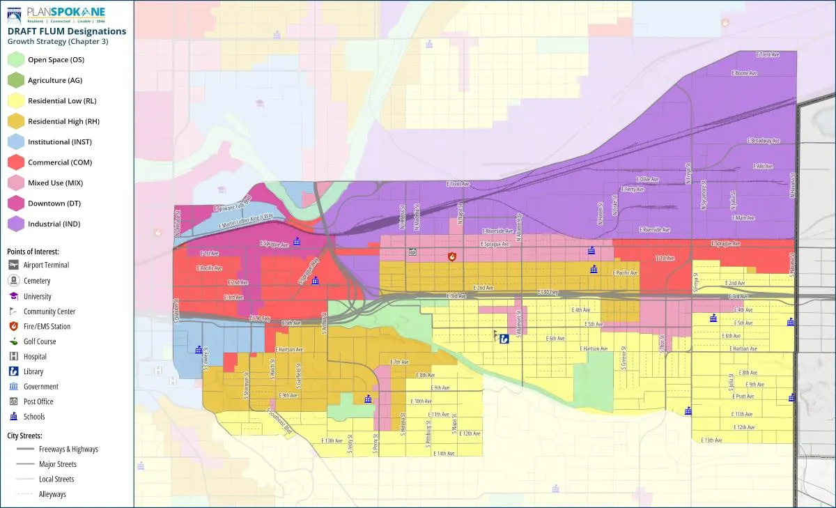
East Central if the proposed map is approved
  • Mixed Use: expands at Fifth and Altamont
  • Residential High: is added behind Fred Meyer
  • Mixed Use: expands around Perry
  • Residential High: expands around Perry
  • Institutional: replaces the old map category in the Medical District

West Central Neighborhood

District 3Kitty Klitzke · Zack Zappone

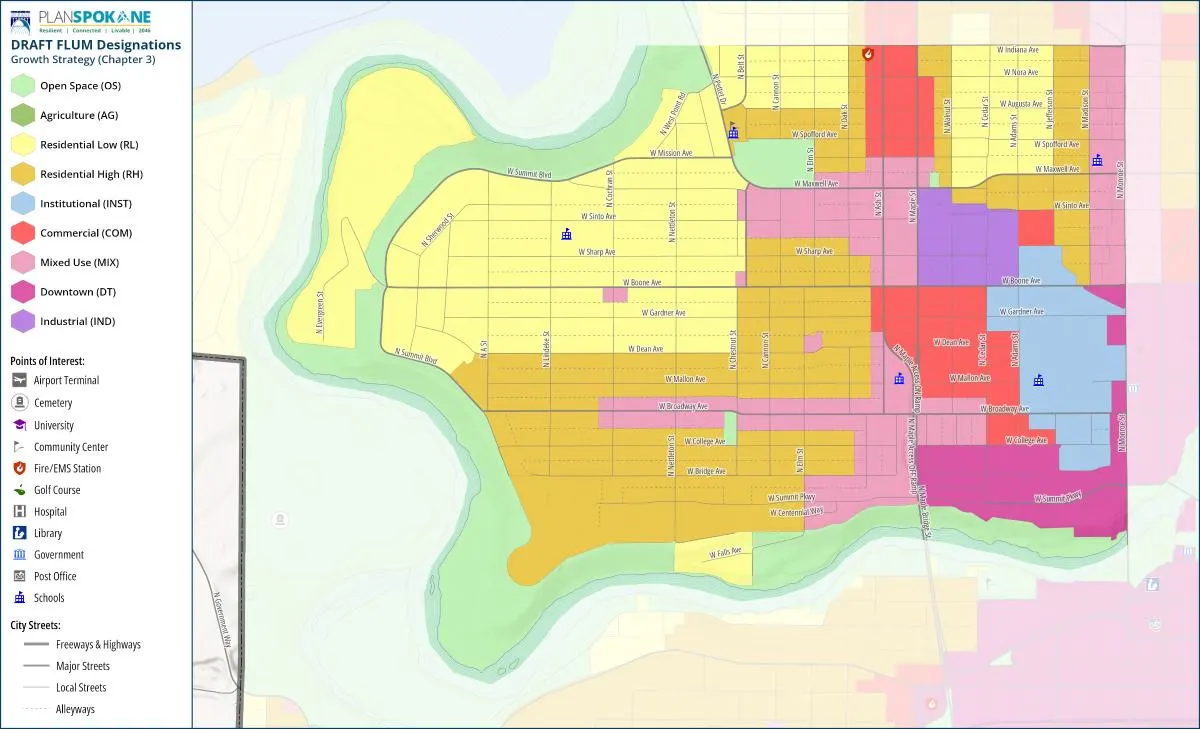
West Central if the proposed map is approved
  • Mixed Use: expands along Broadway, Maxwell, and Monroe
  • Mixed Use: shifts from Maple/Ash toward Maxwell and A.M. Cannon Park
  • Residential High: expands around Monroe, Maple/Ash, Maxwell, and Broadway


Emerson/Garfield Neighborhood

District 3Kitty Klitzke · Zack Zappone

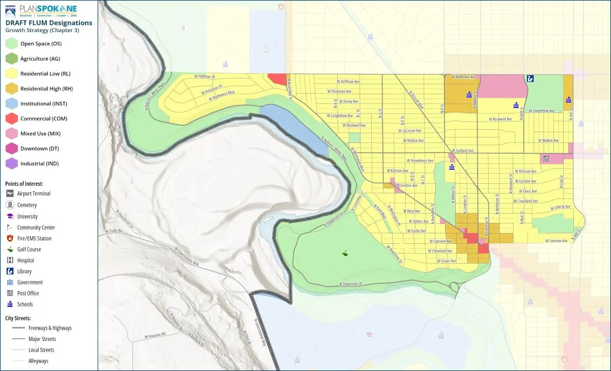
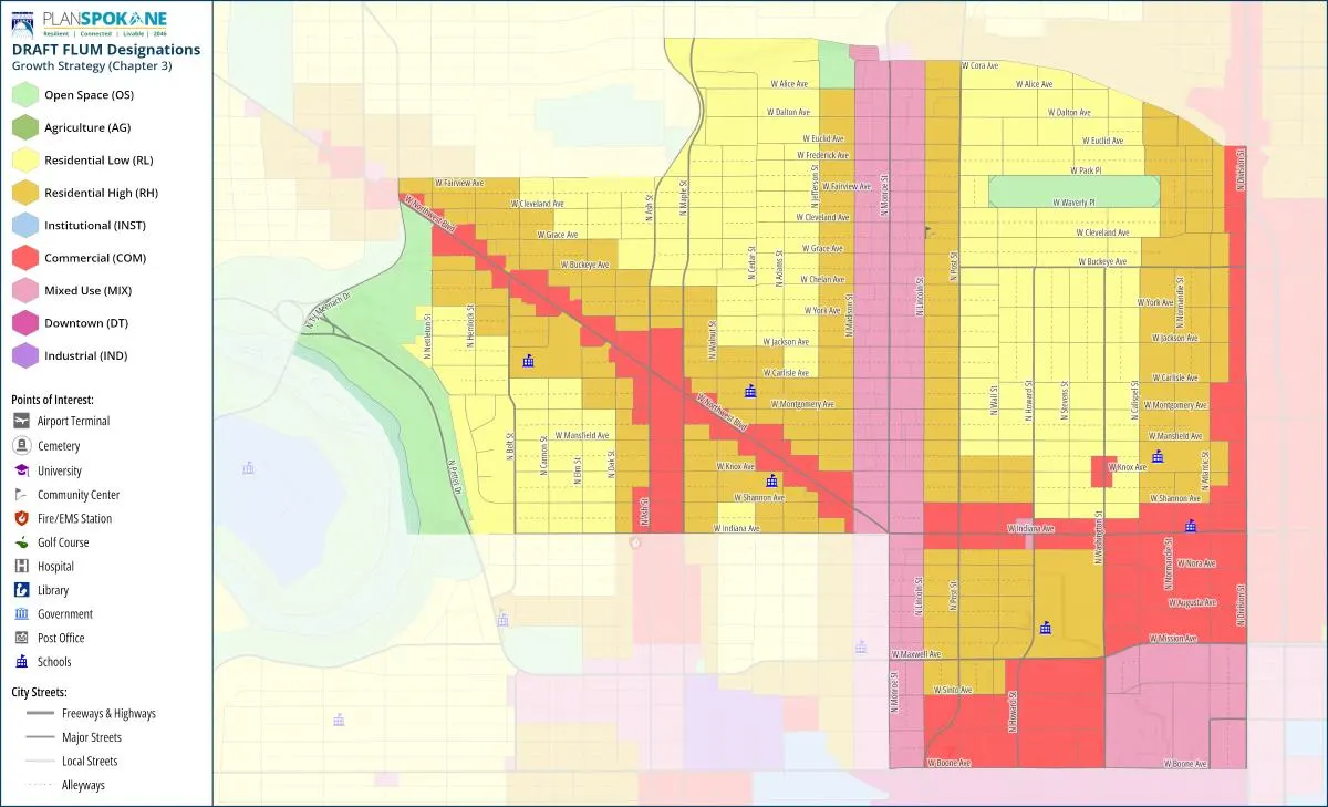
Emerson-Garfield if the proposed map is approved
  • Mixed Use: expands along Monroe
  • Residential High: expands around Mixed Use and Commercial areas
  • Residential High: is added along Northwest Boulevard, Monroe, Maple/Ash, and Division

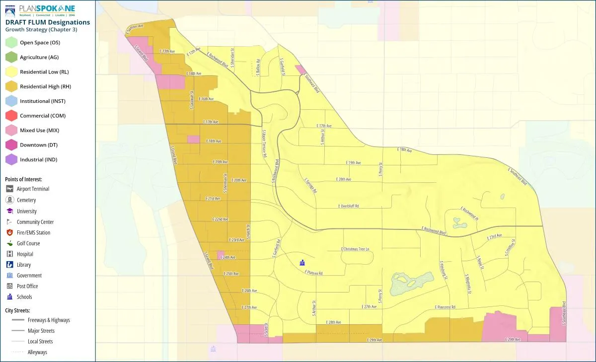
Rockwood Neighborhood

District 2Paul Dillon · Kate Telis

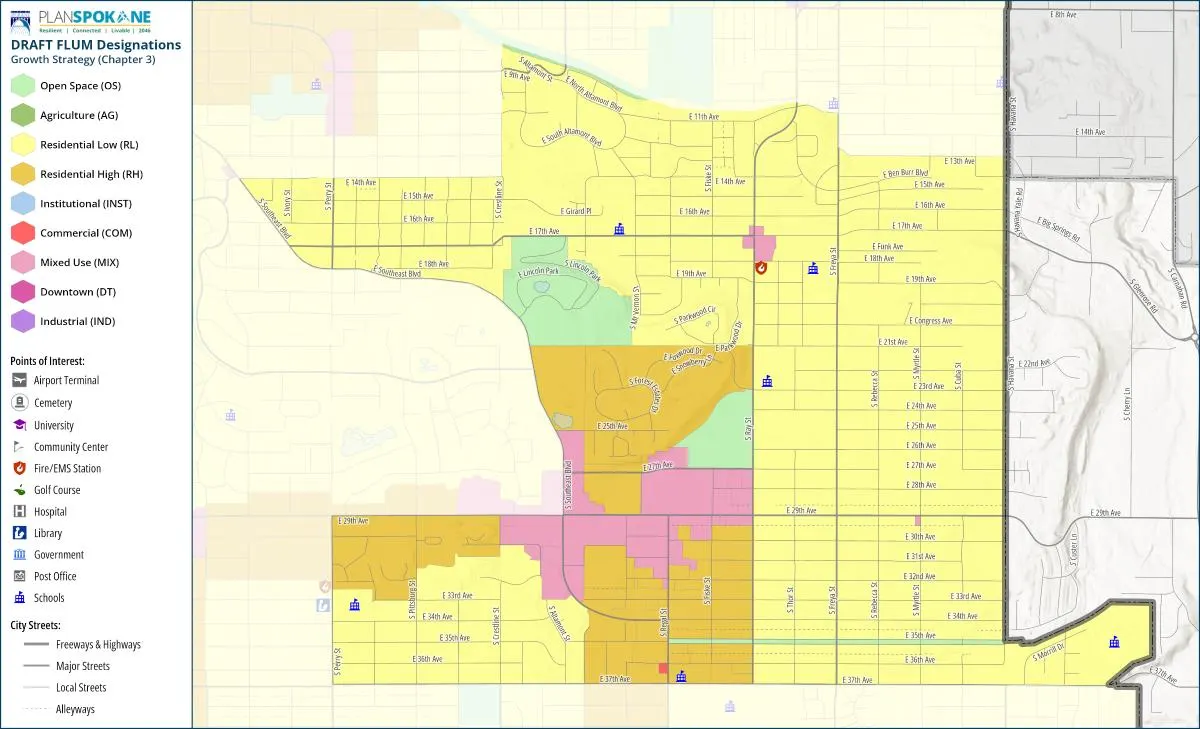
Rockwood if the proposed map is approved
  • Mixed Use: expands at Grand and 14th, Grand and 29th, and near 29th and Southeast
  • Residential High: expands along Grand toward Hatch
  • Residential High: is added along 29th between the shopping centers

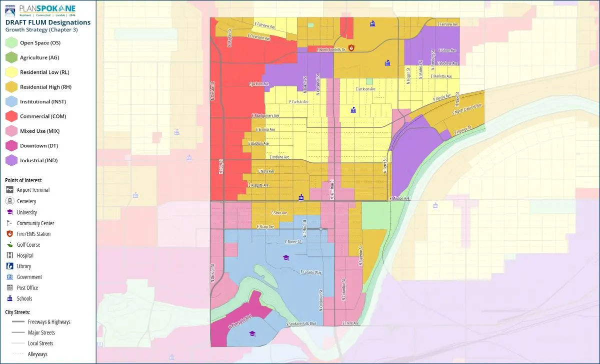
Logan Neighborhood

District 1Michael Cathcart · Sarah Dixit

Logan if the proposed map is approved
  • Residential High: expands south of Indiana and west of Astor
  • Mixed Use: expands along Ruby near planned stops for the faster Division Street bus line
  • Residential High: is added near North Foothills and schools, including some land now shown as Industrial

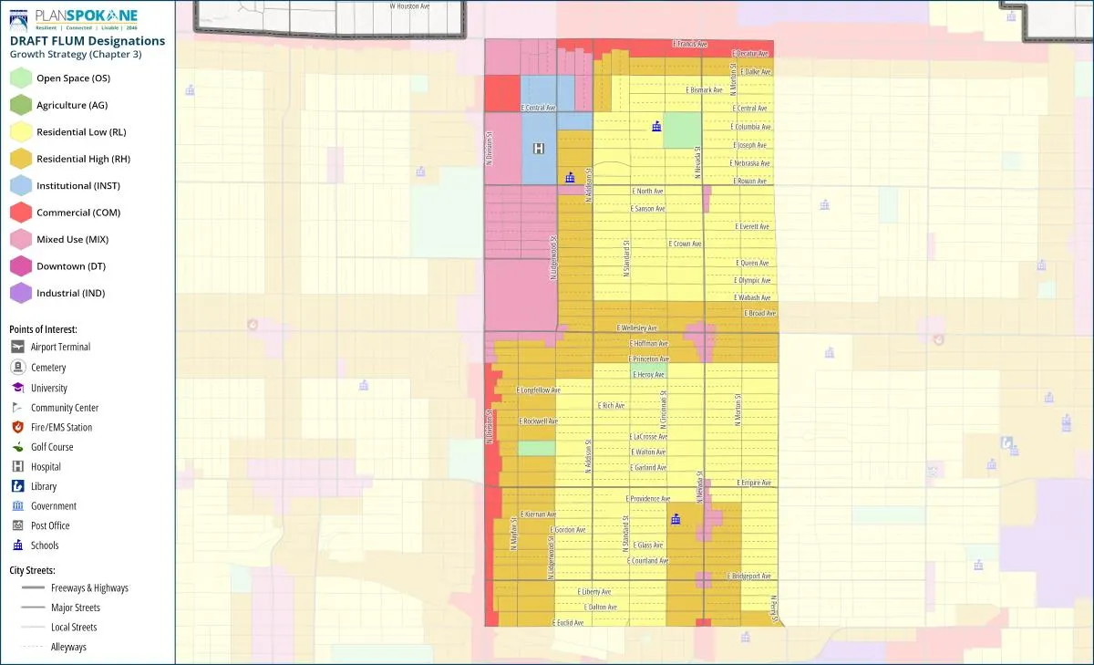
Nevada Heights Neighborhood

District 1Michael Cathcart · Sarah Dixit

Nevada Heights if the proposed map is approved
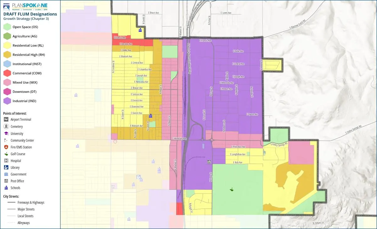
  • Mixed Use: expands on Division between Wellesley and Francis
  • Institutional: replaces the old map category at Holy Family Hospital
  • Residential High: expands near Division, Francis, Wellesley, and southern Nevada Heights

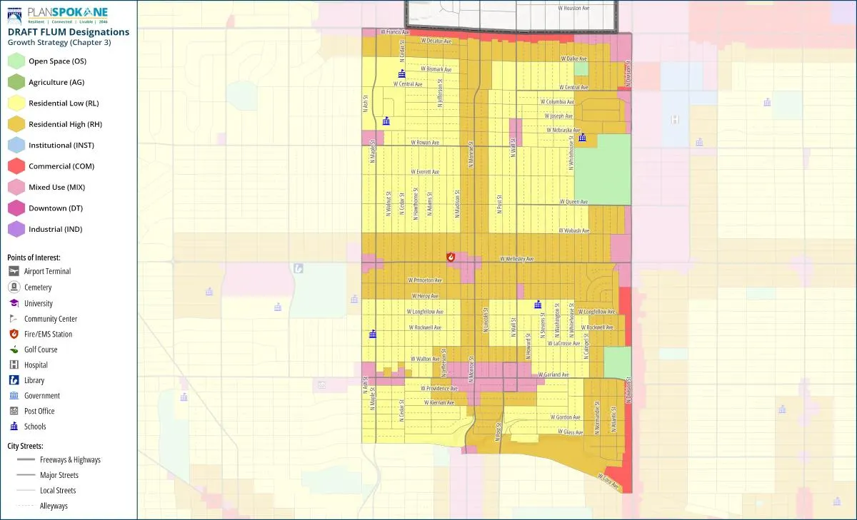
North Hill Neighborhood

District 3Kitty Klitzke · Zack Zappone

North Hill if the proposed map is approved
  • Mixed Use: replaces or expands beyond some Commercial areas
  • Residential High: expands around Francis and Wellesley
  • Residential High: expands along Monroe and Division

Lincoln Heights Neighborhood

District 2Paul Dillon · Kate Telis

Lincoln Heights if the proposed map is approved
  • Mixed Use: replaces Commercial at the shopping center
  • Residential High: expands around the shopping center and Ray
  • Residential High: is added at Rockwood Retirement


  • Bemiss Neighborhood

    More apartments and other higher-density housing along Wellesley and around Haven and Market.

  • Chief Garry Park Neighborhood

    A new Mixed Use area for housing, shops, and services around Napa, Mission, and nearby streets.

  • Shiloh Hills Neighborhood

    More Mixed Use along Division and near Lincoln and Nevada, with Residential High around those areas.

  • Whitman Neighborhood

    Commercial and Residential High expand along Francis and Wellesley.

  • Cliff/Cannon Neighborhood

    More Mixed Use at 14th and Lincoln and 14th and Grand, plus Residential High and an Institutional Medical District.

  • Comstock Neighborhood

    More Mixed Use along Grand from 29th to 38th and Residential High around Grand and 29th.

  • Latah/Hangman Neighborhood

    More Agriculture, Mixed Use, and Residential High along Inland Empire Way.

  • Manito/Cannon Hill Neighborhood

    Residential High expands along Grand.

  • Southgate Neighborhood

    Residential High is added along Regal, Hazel’s Creek becomes Open Space, and some Commercial and Mixed Use areas change.

  • West Hills Neighborhood

    Less Commercial and Residential High and more Open Space around Government and Whistalks, with other changes near Sunset.

  • Balboa/South Indian Trail Neighborhood

    Five Mile Shopping Center becomes Mixed Use, allowing housing alongside shops and services. Separate Indian Trail changes depend on an agreement between the City and the developer.

  • Five Mile Prairie Neighborhood

    Residential High is removed near Chadwick and Open Space expands from Austin Ravine toward Sky Prairie.

  • Northwest Neighborhood

    Residential High is added near Assembly and along Wellesley and Francis.

Minimal or no proposed changes

6 neighborhoods

You lucked out. Maybe. Good news if you wanted the map to stay put. Less exciting if you hoped to build something new. Either way, you still get the map. No disappearing acts.

  • Riverside Neighborhood

    Two small changes: the Tribal Gathering Place becomes Open Space and the Bosch parking lot becomes Downtown.

  • Minnehaha Neighborhood

    The City says changes are limited to North Spokane Corridor land and do not affect private property.

  • Grandview/Thorpe Neighborhood

    The City proposes no map changes.
  • Browne’s Addition Neighborhood

    The City proposes no map changes.
  • North Indian Trail Neighborhood

    The City proposes no map changes.
  • Peaceful Valley Neighborhood

    The City proposes no map changes.
What should Spokane demand?

Show what each change delivers, who benefits, what is protected, who pays, and how the public will know whether it worked.